Definitionپێناسە
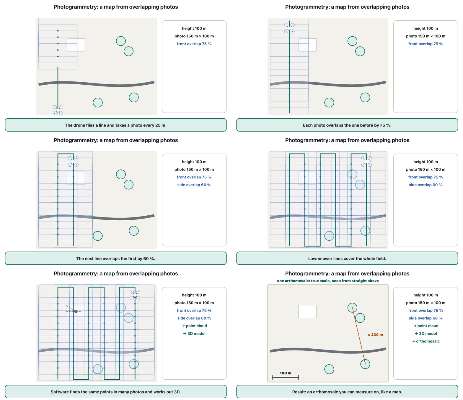
Measuring the real world from many overlapping photos: software finds the same points in different pictures and works out their 3D positions. A drone flying 'lawnmower' lines with about 70-80 % overlap gives a , an and a 3D model.
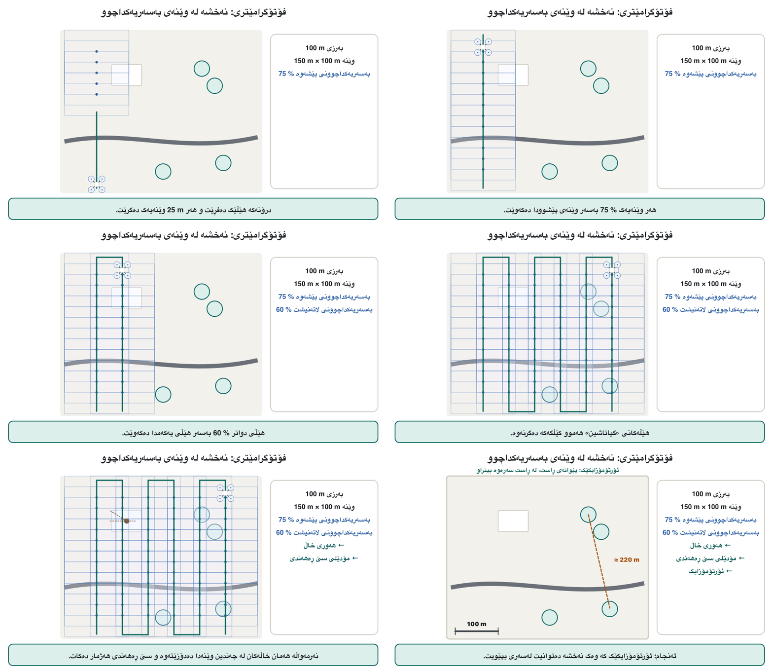
پێوانکردنی جیهانی ڕاستەقینەیە لە ڕێگەی چەندین وێنەی بەسەریەکداچووەوە: هەمان خاڵەکان لە وێنە جیاوازەکاندا دەدۆزێتەوە و شوێنە سێ ڕەهەندییەکانیان هەژمار دەکات. کە بە هێڵی وەک «گیاتاشین» و بە نزیکەی 70 تا 80 % بەسەریەکداچوون دەفڕێت، ، و مۆدێلێکی سێ ڕەهەندی دەدات.
Picturesوێنەکان
Exampleنموونە
A building company flies a photogrammetry mission every week to compare the real site with the plan.
کۆمپانیایەکی بیناسازی هەموو هەفتەیەک بۆ دەفڕێنێت، بۆ ئەوەی شوێنی کارەکە لەگەڵ پلانەکەدا بەراورد بکات.
Other Kurdish renderings in useوەرگێڕانە کوردییەکانی تر
پێوانکاری بە وێنە، فۆتۆگرامێترییەکە، فۆتۆگرامێتریی
Note on the Kurdish termتێبینی لەبارەی زاراوە کوردییەکە
Proposed loan (Persian «فتوگرامتری»); «پێوانکاری بە وێنە» (measuring with pictures) is the descriptive alternative. The notes' 'accurate 3D models of construction sites' (drn.dt.p04.t04); workflow and overlap: USGS data release (drn.x12).
Related termsزاراوە پەیوەندیدارەکان
Learn more inزیاتر فێربە لە
- Payloads and Mapping: Cameras, Thermal, LiDAR and Photogrammetryباری درۆن و نەخشەکێشان: کامێرا، گەرمی، لایدار و فۆتۆگرامێتری
- Drones at Work: Farms, Building Sites, Emergencies, Media and Deliveryدرۆنەکان لە کاردا: کێڵگە، شوێنی بیناسازی، فریاکەوتن، میدیا و گەیاندن
- Autonomy, Swarms, Air Taxis and the Future of Dronesسەربەخۆیی، ڕەوەکانی درۆن، تەکسییە ئاسمانییەکان و داهاتووی درۆنەکان